Файл:DeirYassinWiki.jpg
Исходный файл (935 × 824 пкс, размер файла: 253 КБ, MIME-тип: image/jpeg)
DeirYassinWiki.jpg, Commons.
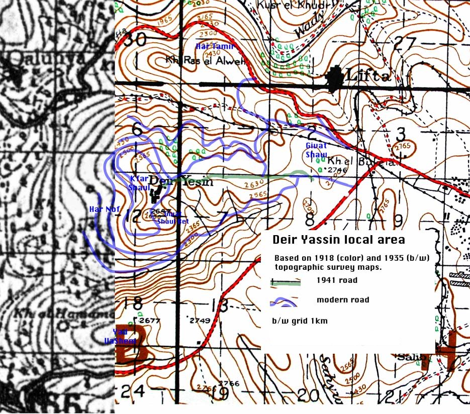
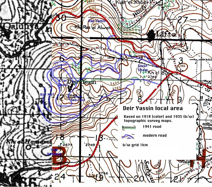
Deir Yassin local area
This map is based on a British army topographic map at 1:63,360, dated 1918 (the color portion), plus a British topographic map at 1:100,000, dated 1941 (the black and white portion). The two parts don't join exactly due either to map inaccuracy or the alteration of the roads. I have also shown the main additional roads in 1941 (green) and some of the modern roads (blue). The words in blue are modern suburb names. The actual site of Deir Yassin is now the Kfar Shaul psychiatric hospital.
История файла
Нажмите на дату/время, чтобы увидеть версию файла от того времени.
| Дата/время | Миниатюра | Размеры | Участник | Примечание | |
|---|---|---|---|---|---|
| текущий | 14:53, 12 апреля 2016 | | 935 × 824 (253 КБ) | Igorp lj (обсуждение | вклад) | [https://commons.wikimedia.org/wiki/File:DeirYassinWiki.jpg DeirYassinWiki.jpg], Commons. <br> Deir Yassin local area <br> This map is based on a British army topographic map at 1:63,360, dated 1918 (the color portion), plus a British topographic map a… |
Вы не можете перезаписать этот файл.
Использование файла
Следующие 2 страницы используют этот файл: